

FAA PART 107 CERTIFIED


FULLY INSURED


OSHA SAFETY COMPLIANT


PRE-FLIGHT RISK ASSESSMENT
WASHINGTON COUNTY DRONE SERVICES
More Than Aerial
Footage
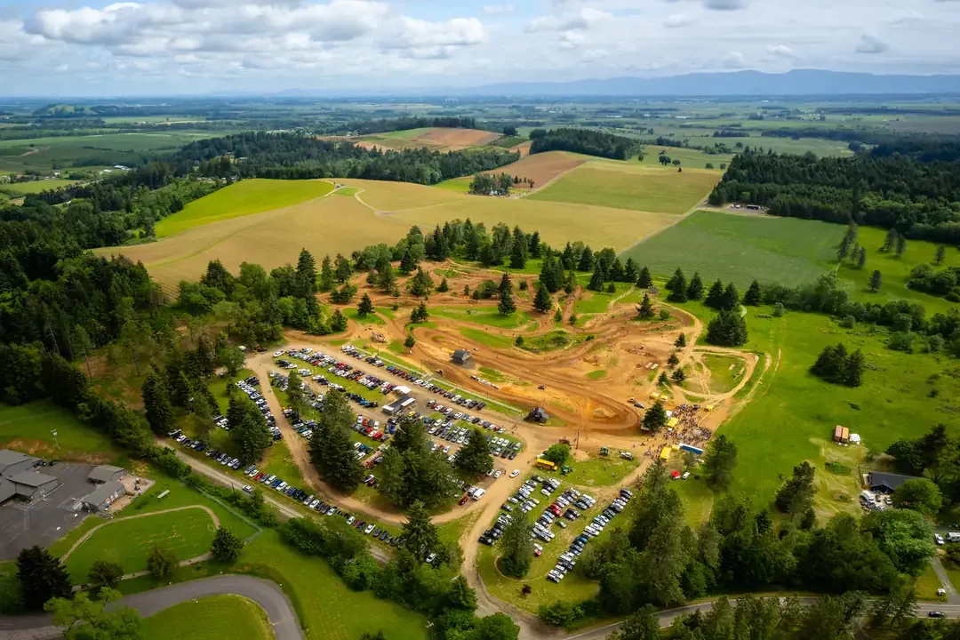
When businesses need aerial photography in Washington County, they usually need visuals that serve a real purpose. That may mean marketing a property in Beaverton, documenting a job site in Hillsboro, capturing a venue in Tigard, or creating branded imagery for a commercial project in Forest Grove.
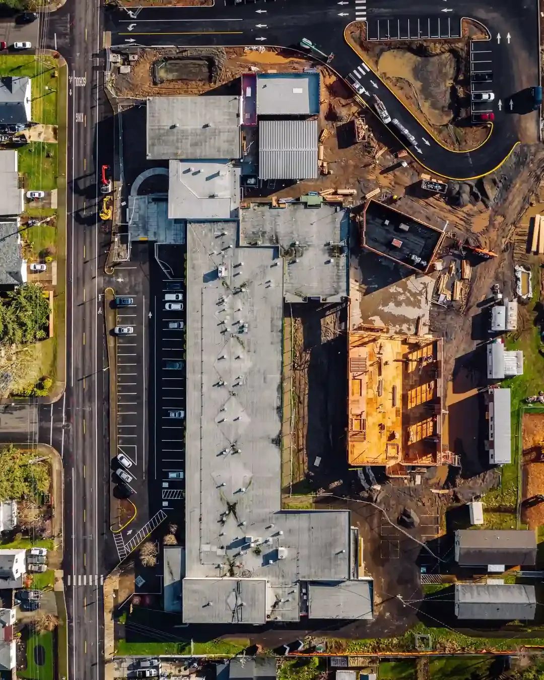
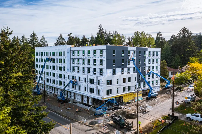
Professional aerial photography gives businesses across Washington County a better view of scale, layout, progress, and surrounding context. That is especially valuable for construction sites in Hillsboro, commercial properties in Beaverton, event venues in Tigard, and business locations in Forest Grove, Tualatin, Sherwood, Cornelius, Aloha, Bethany, and North Plains.
A successful drone project starts before takeoff. It requires planning around location conditions, airspace, safety considerations, timing, and end use so the final assets are useful from the moment they are delivered anywhere in Washington County.
WHO WE ARE
Aerial Photography Company in
Washington County, Oregon
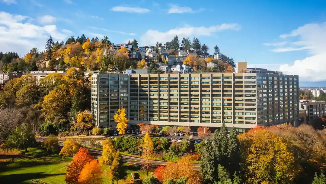
Aerial photography should do more than add visual interest. It should help support marketing, documentation, reporting, inspections, and stronger communication across teams throughout Washington County.
This service is designed for commercial clients in Hillsboro, Beaverton, Tigard, and Forest Grove that need dependable execution, polished image quality, and a professional process from start to finish.
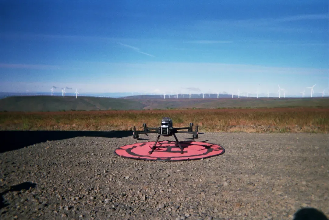
Pilots are FAA Part 107 licensed and fully insured, with experience supporting businesses and organizations across construction, real estate, events, infrastructure, and commercial marketing throughout Washington County.
THE TEAM
Meet Your Washington County Aerial Photography Team
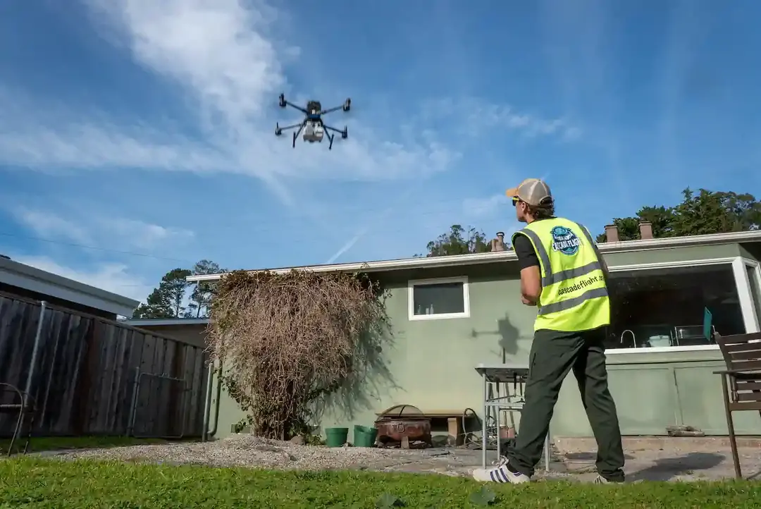
Hiring an aerial photography team means hiring a partner that understands more than drone flight.
It means working with professionals who know how to capture usable visual assets that fit a timeline, support a brand, and align with a business goal anywhere in Washington County.
Whether the need is a one-time photo shoot in Beaverton, recurring project documentation in Hillsboro, venue coverage in Tigard, or commercial imagery in Forest Grove, the focus stays on safe operations, strong visuals, and reliable service.
Projects in Tualatin, Sherwood, Cornelius, Aloha, Bethany, and North Plains benefit from the same attention to planning, communication, and organized delivery. The goal is not simply to capture images from above, but to deliver assets that are ready to use and easy to share.
THE TEAM
Zane Andrews
Background: I bought my first drone in 2019 and became Part 107 licensed in 2020. I cut my teeth interning for a local construction company while in college and documenting progress on their sites. After branching out to other clients in different industries, I decided to start Cascade Flight. Outside of the business, you can find me playing poker, pickleball, or boxing.
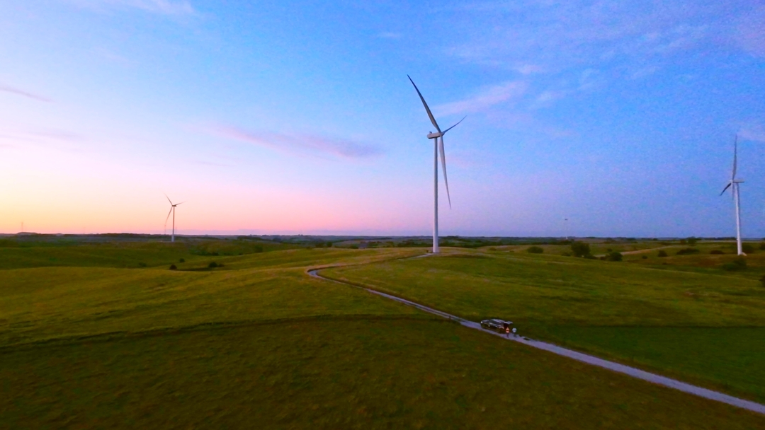
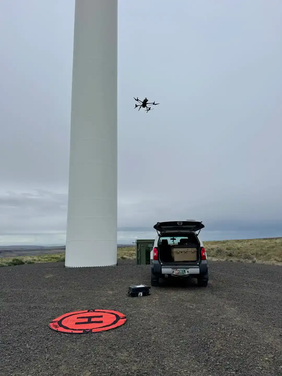
Experience: Over 300 flight hours on missions inspecting wind turbines, documenting live construction sites, and filming world records!
HOW WE HELP
How Our Team Can Help Businesses in Washington County
Professional commercial drone services can support a wide range
of business needs throughout Washington County
Marketing-ready aerial images for websites, ads, brochures, and social media
Property and site overviews that show layout, access, and surrounding context
Construction progress photography for owners, partners, and stakeholders
Visual documentation for commercial and infrastructure assets
Event and venue imagery that highlights atmosphere and scale
Branded content for agencies, developers, hospitality teams, and commercial brands
Organized file delivery for internal teams, clients, and partners
These services support businesses in Hillsboro, Beaverton, Tigard, and Forest Grove that need stronger visual assets. The same applies to organizations in Tualatin, Sherwood, Cornelius, Aloha, Bethany, and North Plains that need professional aerial imagery for marketing, reporting, or documentation.
BEFORE YOU BOOK
Important Initial Advice
If you are looking for commercial drone services in Washington County, it helps to define your goals before booking a flight. Better planning usually leads to better results, whether the project is in Hillsboro, Beaverton, Tigard, or Forest Grove.
Decide how the aerial content or data will be used for reporting, inspections, marketing, stakeholder updates, or internal documentation
Determine whether you need still photography, video, mapping support, inspection imagery, or a combination of services
Share any project deadlines, milestones, or scheduling constraints early
Confirm site access and any location-specific requirements
Avoid last-minute scheduling where weather, airspace, or site activity may affect the mission
Start the planning process early so the project runs smoothly
Early planning is just as helpful for projects in Tualatin, Sherwood, Cornelius, Aloha, Bethany, and North Plains, where access, timing, or site logistics may shape the final schedule.

PLANNING YOUR SHOOT
Timing And Scheduling
Scheduling matters in commercial drone work. In Washington County, project timing can affect lighting, weather, site activity, access, traffic flow, and the overall efficiency of the flight. Planning ahead gives more flexibility to align drone coverage with construction milestones, inspection windows, marketing deadlines, or event schedules.
That matters for active sites in Hillsboro, commercial projects in Beaverton, venue coverage in Tigard, and property or infrastructure work in Forest Grove. The same is true for projects in Tualatin, Sherwood, Cornelius, Aloha, Bethany, and North Plains where access windows or site conditions can affect timing.
Starting early also gives time to review logistics and make sure the location can be captured safely and efficiently. That often leads to better deliverables and a less stressful production process anywhere in Washington County.
PROJECT PREPARATION
Gathering Project Information
To get the most value from a commercial drone project, it helps to gather a few important details as early as possible.
Site address and property details
Type of service needed
Scope of coverage required
Preferred angles, assets, or areas to highlight
Timeline and delivery expectations
Start the planning process early so the project runs smoothly
This process helps clients across Washington County, including those in Hillsboro, Beaverton, Tigard, and Forest Grove. It also improves project clarity for businesses in Tualatin, Sherwood, Cornelius, Aloha, Bethany, and North Plains that want stronger alignment between the flight and the final deliverables.

PRICING
How Much Aerial Photography Cost?
Pricing for aerial photography in Washington County depends on the location, scope, scheduling needs, deliverables, and whether the project involves photography, video, inspections, mapping, or recurring site visits.
Instead of using one-size-fits-all pricing, we build each quote around the work involved so clients get the right coverage, the right deliverables, and a solution that fits the project from the start.


Project-Based Pricing
Custom quotes built around your scope, location, and deliverables — no guesswork.


Recurring Partnerships
Scheduled documentation packages for ongoing construction sites and facilities.


Free Consultation First
Every project starts with a conversation to understand the scope before any pricing.


PRICING
Why Choose Us Over Other Washington County Aerial Companies?
The real difference is not the equipment alone. It is the planning, and professionalism behind the work. Clients typically look for a provider that offers:
FAA Part 107 licensed pilots with documented flight hours and regulatory compliance
Fully insured operations with comprehensive commercial coverage on every project
Safety-first planning and execution with documented pre-flight risk assessments
High-quality commercial aerial imagery shot on professional-grade drone systems
Clear communication from consultation through delivery with no surprises
Regional availability with the ability to support projects nationwide
CLIENT REVIEWS
What Our Clients Say
OUR SERVICES
Types of Aerial Services
We Handle
Commercial drone services are often part of a broader business
need. Related services may include:


Construction Drone Services
Progress documentation, site overviews, and stakeholder reporting visuals.


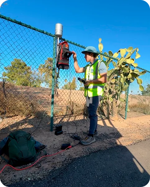
Infrastructure Inspections
Roof, structural, transmission, and hard-to-access asset documentation.


Event Drone Coverage
Venue scale, crowd activity, and event highlight footage from the air.


Mapping & Photogrammetry
2D orthomosaic maps, 3D models, and volumetric analysis for planning and reporting.


Aerial Photo & Video
Broadcast-quality cinematics for marketing, branding, and promotional use.


Commercial Marketing Visuals
Property showcases, brand content, and campaign-ready aerial imagery.


Energy & Utilities Services
Solar thermal inspections, wind turbine documentation, and substation flyovers.


Live Sports Coverage
Stadium-compliant TFR authorization and direct broadcast feed integration.


Advertising Content Production
Cinematic aerial content designed for campaigns, social, and paid media.
FAQ
Frequently Asked Questions
Aerial photography is available for construction, real estate, infrastructure, events, commercial marketing, and branded content throughout Washington County, including Hillsboro, Beaverton, Tigard, Forest Grove, Tualatin, Sherwood, Cornelius, Aloha, Bethany, and North Plains.
Yes. All commercial drone operations are performed by FAA Part 107 licensed pilots for projects throughout Washington County.
Yes. Operations are fully insured. Any project-specific insurance requirements for sites in Hillsboro, Beaverton, Tigard, Forest Grove, Tualatin, Sherwood, Cornelius, Aloha, Bethany, or North Plains should be confirmed during planning
Yes. Many projects in Washington County combine still photography and video for a more complete set of deliverables.
Common clients include construction firms, developers, real estate teams, agencies, venues, hospitality brands, infrastructure stakeholders, and event organizers in Hillsboro, Beaverton, Tigard, Forest Grove, Tualatin, Sherwood, Cornelius, Aloha, Bethany, and North Plains.
That depends on the property, deliverables, and scheduling requirements. Some shoots in Hillsboro or Beaverton are straightforward, while projects in Tigard, Forest Grove, Tualatin, Sherwood, Cornelius, Aloha, Bethany, or North Plains may need more planning and coordination.
No. Service is available across Washington County, including Beaverton, Tigard, Forest Grove, Tualatin, Sherwood, Cornelius, Aloha, Bethany, and North Plains, as well as the surrounding metro, the Pacific Northwest, and projects nationwide
Use the contact form, share the location, timeline, and project goals for your project in Washington County. We'll follow up to discuss scope and pricing.
SERVICE AREA
Areas We Serve in Washington County, Oregon
Service is available throughout Washington County, including Hillsboro, Beaverton, Tigard, Forest Grove, Tualatin, Sherwood, Cornelius, Aloha, Bethany, and North Plains.
Businesses in Hillsboro often need aerial imagery for construction, commercial marketing, and real estate. Businesses in Beaverton use aerial photography for development, property promotion, and documentation. Projects in Tigard often benefit from aerial coverage for venues, commercial sites, and surrounding context. Clients in Forest Grove use drone imagery for property visuals and project communication.
Hillsboro
Tigard
Tualatin
Cornelius
Bethany
Beaverton
Forest Grove
Sherwood
Aloha
North Plains
Ready to get started?
Tell us about your project in Washington County and we'll build a solution around it.