- Published on
Real Estate Drone Photography in Portland: What Agents Should Expect
You've got a great listing, and you want it to stand out the moment it hits the market. So you book a drone shoot. But here's what too many Portland agents have learned the hard way: not all aerial work is the same. One operator delivers crisp, listing-ready photos in two days. Another hands you shaky footage a week late — or worse, footage you legally can't use.
The problem isn't the drone. It's who's flying it. A hobbyist with a consumer drone and a real estate drone photography professional can take off from the same driveway and hand you completely different results. If you don't know what good looks like, it's hard to tell the difference until the listing is already live.
This guide fixes that. Here's exactly what to expect from professional real estate drone photography in Portland — the deliverables, the turnaround, and the compliance details that protect you and your client.
What Good Real Estate Drone Media Actually Includes
"Drone photos" is a broad term. A strong package gives you more than a few shots from above. It gives you a set of media built to sell the home and the location together.
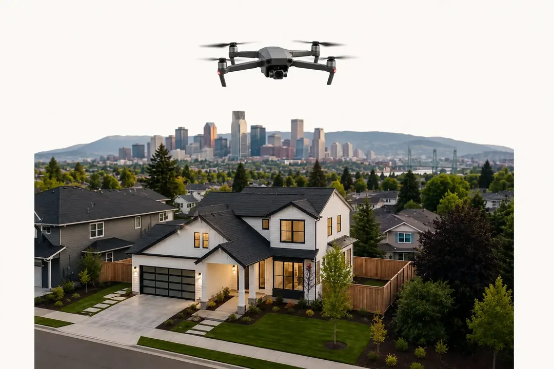
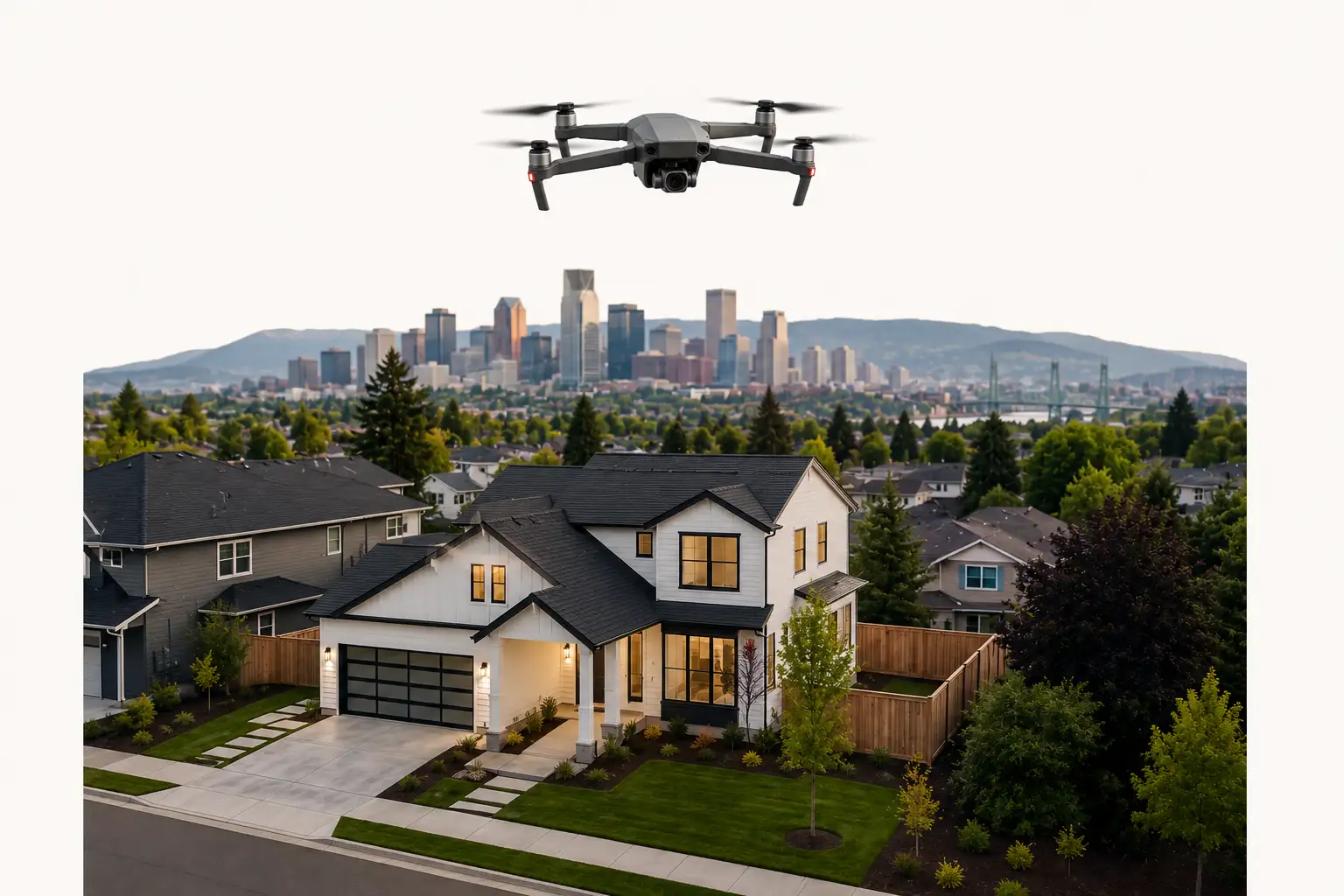
- Aerial stills. High-resolution photos that show the lot lines, the yard, the roof, and how the property sits in its neighborhood. These are the shots that answer a buyer's first questions before they ever schedule a tour.
- Aerial video. A smooth, cinematic flight that pulls back from the front door to reveal the whole property and the streets around it. Video keeps buyers on your listing longer and gives you something to share on social.
- Twilight shots. Photos captured at dusk, when the sky glows and the home's lights are on. Twilight aerials are some of the most clicked images in real estate marketing — they make a listing feel premium.
- Ground and aerial combined. The best drone real estate photography pairs the aerial work with on-the-ground exterior and interior shots, so you get one consistent set of media instead of two mismatched batches.
A good aerial photographer in Portland will talk through which of these your listing actually needs before the shoot — not just show up and fly.
Turnaround and Listing-Platform Compliance
In real estate, timing is everything. A listing that goes live with full media beats one that waits three days for photos. Professional drone services understand that. Standard turnaround should be fast — typically a few business days, with rush options when you've got a Friday listing deadline.
Just as important: the files have to actually work on your platforms. That means images sized and formatted to meet RMLS and MLS upload rules, video in a format your listing sites and social channels accept, and a delivery method that doesn't leave you fighting with a download link an hour before you publish. Getting professional drone photos for realtors is only useful if they drop straight into your listing without extra work.
When you hire someone, ask two questions up front: how fast is delivery, and will the files meet my listing platform's specs? A real answer to both is a sign you're working with a pro.
Why Licensed and Insured Matters for Listing Use
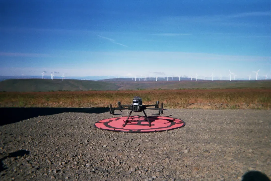
This is the part hobbyist operators skip, and it's the part that can cost you. Flying a drone for a paid listing is commercial work. Under FAA rules, that requires a Part 107 certified pilot. Full stop.
If you use footage from an unlicensed flight on a listing, you're putting your brokerage's name behind work that wasn't legal to perform. And if an uninsured operator damages the property — or a neighbor's — during the shoot, that exposure can land on you. Hiring a licensed, fully insured aerial photographer isn't red tape. It's the thing that keeps your listing clean and your liability covered.
Every Cascade Flight mission is flown by an FAA Part 107-certified, fully insured pilot, with a pre-flight check done before takeoff. That's the baseline for any drone real estate services you put your name on.
The Portland Airspace Detail Most Agents Don't Know
Here's something that catches a lot of listings off guard: large parts of Portland sit in controlled airspace. The area around PDX is Class C airspace, and flying a drone there legally requires authorization through the FAA's LAANC system before takeoff. There are also restrictions and sensitive zones along the Willamette River and near other local airfields.
A hobbyist often doesn't know this — or ignores it. A professional handles it as part of the job. When a listing falls inside controlled airspace, we secure the authorization ahead of the shoot so the flight is legal and on schedule. You don't have to think about it, which is exactly the point. That local knowledge is part of what you're paying a Portland aerial photographer for, not just the camera.
What's at Stake If You Cut Corners
A bad drone shoot doesn't just waste a few hundred dollars. It can mean a delayed listing, footage you can't legally post, a property that photographs worse than the home next door, or a liability claim you never saw coming. In a competitive Portland market, your media is often the first impression — and you only get one.
Professional real estate drone photography flips that. Sharp stills, cinematic video, fast turnaround, and clean compliance mean your listing looks its best and goes live on time, every time. That's the difference between media that sells the home and media that holds it back.
Let's Make Your Next Listing Stand Out
You shouldn't have to gamble on whether your aerial media will be usable. The right partner makes it simple: professional photos and video, delivered fast, ready for your listing, and flown legally.
Cascade Flight provides real estate drone photography and videography across Portland, the metro area, and the wider Pacific Northwest. Every shoot is flown by an FAA Part 107 certified, fully insured pilot who knows the local airspace and delivers listing-ready media on your timeline.
To get media that helps your next listing stand out, request a quote or explore our Real Estate services.