Marketing & Media
Drone Photography for Marketing & Media
High-quality aerial photography and video give marketing and media teams a way to present properties, destinations, and developments from perspectives that ground-based visuals can't capture. Cascade Flight produces professional drone imagery that makes scale, layout, and surroundings legible at a glance — so an audience understands a property before they ever visit it.
From resorts and vacation properties to real estate and commercial developments, aerial visuals create an immersive experience that holds attention. Wide-angle perspective paired with smooth, cinematic motion elevates listings, promotional campaigns, and investor presentations — extending reach and changing how a property is experienced and shared. We don't approach this as enthusiasts with cameras. Every flight is flown by a certified, insured pilot to a documented standard.
What Aerial Photography For Marketing Delivers
Context the curb can't show
Highlight the area around a property, from nearby attractions to surrounding scenery.
Never-before-seen viewpoints
Angles and elevations that change how a property reads.
Immersive video and virtual tours
Marketing content that mimics walking the site in person.
Refreshed digital presence
High-definition images, panoramic photos, and video ready for your website.
Print-ready
assets
Stunning photographs for brochures and printed collateral.
CORE SERVICES
Industries That Use Aerial Marketing
We provide comprehensive aerial photography and videography across a range of industries — the value of image capture extends well beyond marketing and media alone.

Real Estate & Property Management
Professional aerial photography and video give real estate and property management teams a clearer, more compelling way to present listings. High-resolution imagery captures layout, surroundings, and key amenities — context that helps a listing stand out. From residential homes to multi-unit and commercial properties, aerial visuals shorten marketing cycles by giving buyers and tenants a real understanding of the property before they visit.

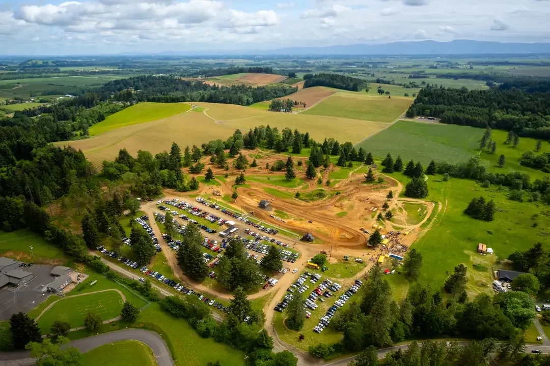
Golf Courses
Aerial photography and video showcase a course the way ground-based imagery can't — capturing layout, elevation changes, and surrounding scenery. High-resolution visuals become marketing assets that promote membership, tournaments, and events, and give players a true sense of the course before they ever step onto the fairway.
Tourism & Hospitality
Professional aerial imagery helps hotels, resorts, and destinations capture attention and set the tone for the guest experience. Drone photos and video highlight location, amenities, and nearby attractions — engaging content for websites, social media, and promotional campaigns that encourages travelers to explore, book, and share.

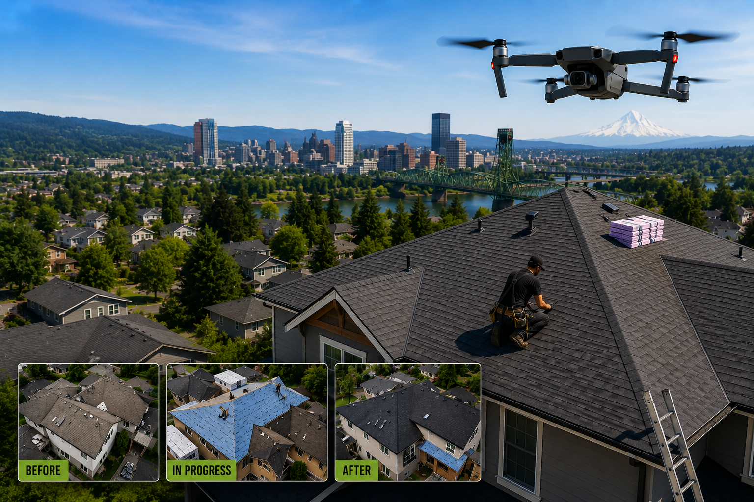
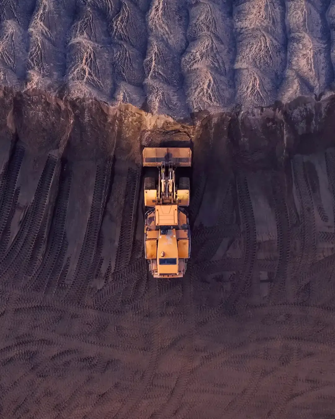
Drone Mapping & Inspections
Cascade Flight provides mapping and inspection services that support documentation, monitoring, and visual storytelling across a project's lifecycle. High-resolution imagery tracks progress, documents site conditions, and produces time-lapse visuals from start to finish — keeping stakeholders and investors informed with clear, current visuals they can trust.
OUR VALUE
The Value of Aerial Data
Aerial data has fundamentally changed how modern organizations plan, monitor, and promote their work. Traditional ground-based documentation can limit visibility, slow communication, and create unnecessary safety exposure. Professional drone services solve those challenges by delivering precise, high-resolution perspectives from above — safely, efficiently, and cost-effectively.
We provide commercial drone services that help project managers, engineers, asset operators, and broadcast teams see better so they can make better decisions. Whether documenting construction progress, inspecting energy infrastructure, or capturing dynamic live sports coverage, our aerial imaging solutions provide actionable intelligence when it matters most.
We serve clients throughout the Pacific Northwest and are available nationwide, delivering consistent, safety-first operations across every project.
Golf Courses
Golf Course Drone Photography & Mapping
Golf course drone services including marketing videos, inspections for maintenance and construction, and aerial mapping. The same footage can feed a uniquely modern Digital Yardage Book.
Service 01
Construction Drone Service
Cascade Flight supports contractors, developers, and project managers with high-resolution drone photography, aerial mapping, and 2D/3D site models. Regular drone flights provide clear project tracking, improve communication, and support better site coordination and decision-making.
Service 02
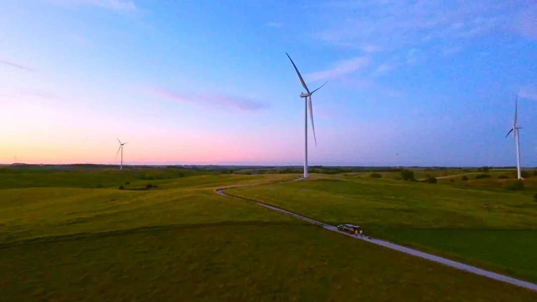
Energy, Utility & Environmental Drone Services
Cascade Flight provides aerial inspections for solar arrays, wind turbines, substations, and utility infrastructure. Using thermal imaging and high-resolution visuals, we help operators identify issues faster, improve maintenance planning, and enhance safety without costly shutdowns or lift equipment.

Service 03
Live Sport & Broadcast Drone
Services
Cascade Flight provides professional drone filming for live sports and broadcast production. We work with production teams to capture smooth aerial shots and venue flyovers, operating safely and in compliance with all airspace regulations — even in complex stadium environments.
SAFETY IS #1
A Drone Company You Can Rely On
Safety and compliance are at the core of every project at Cascade Flight. Our FAA Part 107 licensed pilots operate under strict safety protocols, with fully insured operations and detailed mission planning for every flight.
From construction sites to critical infrastructure and live events, we handle airspace approvals, risk assessments, and regulatory requirements allowing clients to stay focused on their project while we manage the complexities of safe drone operations.
Every pilot is federally licensed for commercial drone operations.
$500k+ Aviation Liability Insurance
Pre-Flight Risk Assessment on Every Job
Night Operations & Stadium TFR Authorized
Our commitment to safety protects your team, your property, and your reputation.
HOW WE WORK
Our Three-Phase Operational Process
We believe professional drone services should be straightforward, transparent, and results-driven. Every engagement begins with a consultation to understand project goals, site conditions, and required deliverables from there, we handle all necessary flight planning and regulatory coordination.
01
Strategic Planning & Airspace Evaluation
We begin with consultation and technical assessment. Preparation eliminates uncertainty before flight operations begin.
- Define project objectives and deliverables
- Evaluate site conditions and operational risks
- Review airspace classification
- Secure necessary authorizations
- Confirm compliance requirements
02
Precision Flight Operations
Flights are conducted by licensed, insured pilots using professional-grade drone systems. Execution is disciplined, efficient, and compliant.
- On-site coordination with stakeholders
- Documented safety protocols
- Controlled airspace compliance
- Stadium TFR and night operation procedures when applicable
- High-resolution image and data capture
03
Processing, Delivery & Integration
The mission concludes with organized, professional deliverables. We provide assets that integrate seamlessly into reporting workflows, marketing systems, and broadcast environments.
- High-resolution imagery processing
- Video editing and formatting
- Mapping and modeling outputs
- Structured file delivery
- Ongoing documentation scheduling for recurring clients
WHY US
Why Cascade Flight
Choosing the right drone service provider impacts safety, compliance, and reliability. Cascade Flight combines FAA-certified expertise, full insurance coverage, and industry experience to deliver dependable aerial solutions across the Pacific Northwest and nationwide with a strong focus on quality and safety.
FAA Part 107 licensed pilots with 300+ documented flight hours across diverse environments
Fully insured with a minimum $500k Aviation Liability policy on every project
Based in the Pacific Northwest with nationwide deployment capabilities
Structured pre-flight planning and documented risk assessments on every engagement
Clear communication and organized delivery from consultation through final file handoff
CLIENT REVIEWS
What Our Clients Say
Ready to Elevate Your Project's
Perspective?
Professional aerial imaging improves clarity, strengthens reporting, and enhances operational efficiency. If you need construction progress monitoring, infrastructure inspection, or live sports drone coverage, Cascade Flight is ready to support your next initiative.
SERVICE AREA
Serving Portland, the Pacific Northwest & Nationwide
Cascade Flight is proudly based in Portland, Oregon. For larger commercial and industrial engagements, we deploy nationwide. Whether supporting an active construction site, conducting an energy infrastructure inspection, or delivering live broadcast coverage, our operational standards remain consistent across every location.
Portland, OR
Hillsboro, OR
Vancouver, WA
United States of America (USA)
Beaverton, OR
Gresham, OR
Broader Pacific Northwest
SERVICE AREA
Drone Services – Frequently Asked
Questions
Yes. We are Part 107 certified, which legally authorizes us to conduct commercial drone operations. We can provide our certificate number upon request.
Yes. We carry commercial drone liability insurance and can provide a Certificate of Insurance (COI). We can also list your company as additionally insured if required.
Yes. If your project requires controlled airspace approval (LAANC), waivers, or special permissions, we manage that process on your behalf. You don’t need to navigate aviation compliance—we take care of it.
We provide professional drone services for:
- Real estate marketing
- Construction progress tracking
- Commercial marketing campaigns
- Aerial photography and videography
Mapping and specialty imaging (when required)
If you have a unique project, we’ll evaluate the scope and recommend the best approach.
We operate professional-grade drones capable of capturing high-resolution 4K (or higher) imagery. Depending on the project requirements, we deploy cinematic drones, stabilized gimbal systems, and specialty equipment. Backup equipment is always available to ensure reliability.
If your project requires thermal inspections, roof analysis, or mapping, we can provide specialized drone solutions designed for accurate data capture. Let us know your objectives, and we’ll advise accordingly.
Standard turnaround time is typically under 5 business days, depending on project complexity. Expedited delivery options may be available if needed.
Safety and image quality both depend on weather conditions. If conditions are unsafe (high wind, rain, restricted visibility), we reschedule at no additional charge.
Every flight follows a structured pre-flight checklist, airspace verification process, weather review, and site safety assessment. We maintain a visual line of sight and follow strict operational protocols to protect people, property, and equipment.
Pricing is project-based or hourly, depending on scope. Quotes clearly detail:
- Flight time
- Editing time
- Travel (if applicable)
- Any required permits or approvals
We believe in transparent pricing without hidden fees.
Professional drone work is more than flying and filming. Cascade Flight provides:
- Legal compliance
- Commercial insurance coverage
- Professional-grade equipment
- Redundant systems and backup gear
- Structured safety protocols
- High-quality post-production
This protects your project, your property, and your brand.